Hi everyone! We're only a year behind now! Drill is same as before - oldest posts at the bottom, most recent at the top so scroll to the bottom and work your way up. Captions are below the picture.

October 24 – We arrived in Yuma

Just a few miles from our campground at Lee Vining, we found
these unusual tufas in Mono
Lake

Relaxing on a (hard) bench at the end of our day at Yosemite .

Climbing the rock wall in the previous picture were two rock
climbers. There is also a third, but only the very top of his/her hat can be
seen at the bottom of the picture. Good
thing Ted has sharp eyes; it took me a long time to find them.

A cliff across from the Yosemite Lodge.

A view of the valley from Tunnel View. On the left is El
Capitan , the largest single rock on earth, standing 4000 feet from
base to summit. It is one of the most
popular destinations for rock climbers.
From left to right – El Capitan ,
Horsetail Fall, Clouds Rest, Hal Dome, Sentinel Rock, Cathedral Rocks and below
Cathedral Rocks is Bridalveil Fall.

Bridalveil Fall – The Yosemite Indians call this place
“Pohono” or spirit of puffing wind. The
wind swirls, often lifting the Fall and blowing it sideways.

Half Dome, once considered “perfectly inaccessible” is now the
destination of thousands of hikers every year. It stands 4733 feet high from
the valley floor and is 87 million years old.

A large granite outcropping – one of many that you find along
the side of the road.

The Tuolumne Meadows in Yosemite National Park

October 22 - Enroute to Lee Vining, CA just outside of Yosemite National Park

Ted watching the dinner cruise boat, the Tahoe Queen, sailing
out of the harbour in Lake Tahoe without him.

The remains of one of the old silver mines just outside of Virginia City .

The Suicide Table located in the Delta saloon. It started its life as a Faro Bank table in
the early 1860s. Unfortunately 3
previous owners are reported to have committed suicide because of heavy losses
at this table. Black Jake lost $70,000
and shot himself. The second owner
couldn’t pay off his losses and either killed himself or was killed. It was stored until the late 1890s when it
was converted to a 21 table. One night a
miner took $86,000, a team of horses and interest in a gold mine from the owner
who then committed suicide. I’d say that
table was jinxed. No wonder they keep it
under plexiglass now.

Our last stop of the day was Virginia
City . During its boomtime, its mining proceeds amounted to
millions of dollars. It was home to
15,000 people and was considered the richest town in America

We stopped at Geiger Lookout where we had a great view of Reno

Our next stop was Reno , NV

This picture in the Museum portrays the hardships faced by the
Donner Party.

Our next stop after having lunch in Truckee was the Emigrant Trail
Museum on the shore
of Donner Lake . I’m sure many of you have heard the story of
the Donner Party who became trapped near the summit of Donner
Pass during the brutal winter of 1846. Eighty-seven pioneers set
out by wagon train from Missouri bound for California Utah ’s Wasatch
Mountains and the Great Salt Lake Desert Donner Pass in early November by severe
weather. Some sheltered in three cabins
at Donner Lake
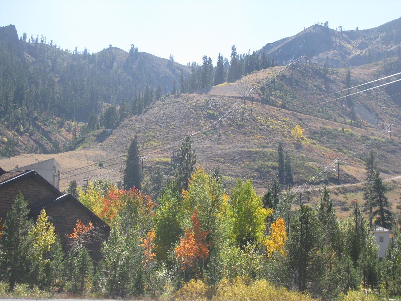
On the north side of the lake is Squaw Valley USA

October 19 – We started our day at the Tallac Historic Site
(several estates from the early 1900s) and then moved along the rugged western
shore of the Lake to Emerald Bay where we had a great view of Fannette Island ,
the only island on Lake Tahoe . The stone building on top that looks like a
little castle is the “Tea
Castle Emerald Bay

The sun setting on Lake Tahoe .

Beautiful Lake Tahoe . Lake Tahoe is the second-deepest lake in the U.S.

October 18 – From the redwoods of California
we headed to the beauty of Lake Tahoe . We needed to make a WalMart/Costco/Target run
so we headed to Carson City ,
Nevada California Alberta ,
Canada Canada ;
Canadians are viciously well-informed about what is happening in the U.S.

We stared at this tree for a long time.
Can you see a face in profile – long ear lobes, high forehead, large
nose, big chin, deep-set eyes, crooked smile?

If you think the trees are big, just look at the roots!

We drove through Jedediah
Smith State
Park

This is one of the giant redwoods and it really is a giant! It is 287 feet high, 23.7 feet in diameter,
has a circumference of 68 feet and is 1500 years old. I love standing beside anything that makes me
look small!

The birds weren’t shy. This one
really liked the top of our truck.

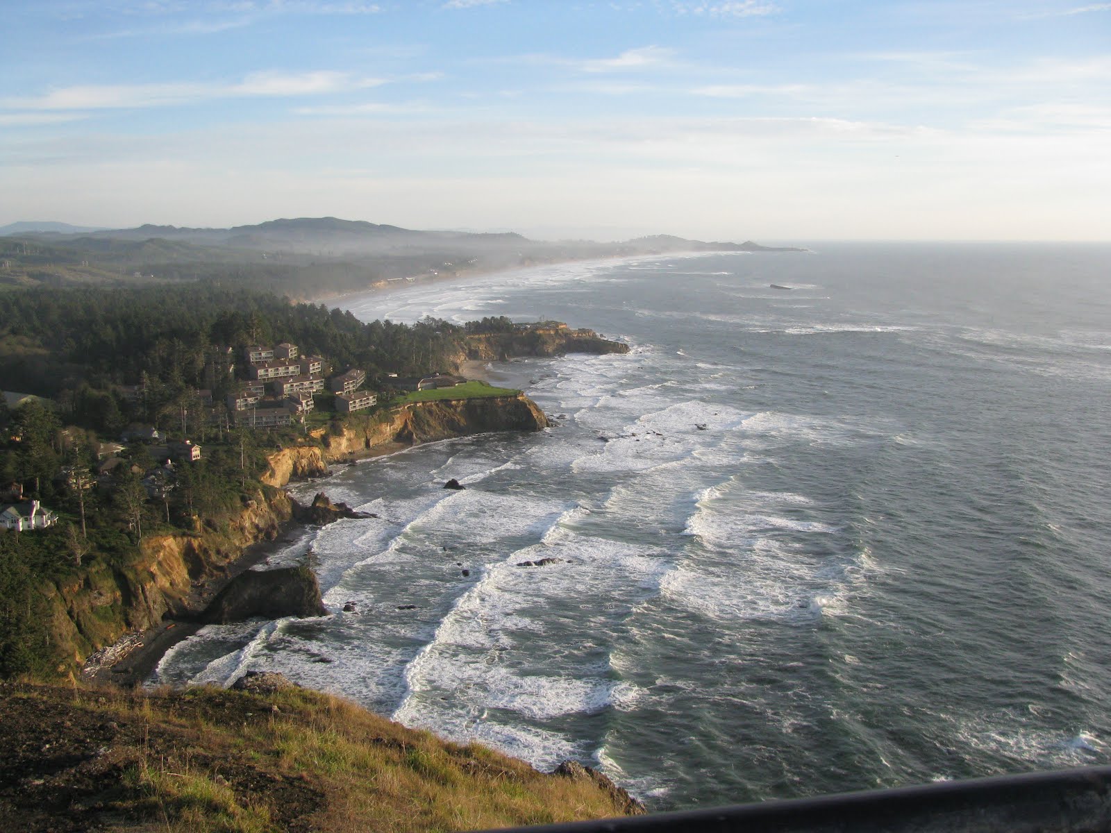
October 15 – From South Beach, we headed to the

With the tide coming in, we also knew we would have a better display of water whipping and tossing its way up the Devil’s Churn, a long crack in the coastal rock that fills with each wave, sometimes exploding as incoming waves collide with outgoing waves.

We went as far south as

The Oregon Dunes National Recreation Area runs for fifty miles between

Further south we pulled over to have a look at the

We hiked one of the many trails in the area and had a beautiful view of the coastline.

October 13 – The following day we headed south from

Sunset at the Yaquina Head Lighthouse.

The Devil’s Punchbowl where water surges in and out of the hole that erosion has created in the rock.


The Spouting Horn created quite a splash.

A beautiful beach near Cape
Kwanda


Looking toward the south, we had great views of Three Arch Rock. Stellar sea lions can often be found on the
rocks.

October 12, 2010 – After celebrating our own Thanksgiving dinner of turkey and all
the trimmings, we moved on to South
Beach , OR Cape Meara Lighthouse
Park

Our next stop was Fort
Stevens State
Park Portland , OR from Mexico

If you saw the 1985 movie, “The Goonies”, starring Sean Astin and Corey
Feldman, you will recognize this as the house used in the movie. It is located
in the seaside town of Astoria ,
OR


The sun was setting on Yale
Lake

Here’s where you come out of the tunnel 50 feet away. The lava forest has now been replaced by a
forest of fern, moss, trees and shrubs.

We completed our day with a hike to Two Forests. In an eruption that took place 2000 years ago
slow-moving molten lava cooled, surrounding trees and hardening. The trees burned to the ground leaving hollow
trunk-shaped holes in the now hardened lava.
You can actually crawl down this hole and follow a tunnel
underground.

On our way back to Ridgefield Mount St. Helens 1900 years
ago. The surface of a lava flow cooled
and hardened, but the molten lava below the surface continued to flow creating
a lava tube.

This tree trunk really caught our imaginations. It could be a giant insect crawling down the
mountain side or perhaps it’s an octopus. What do you think?

We stayed at the top of Windy Ridge viewpoint for a long time waiting and
hoping that the last of the clouds would disappears so we could get a clear
view of the summit, but they never did.
If you look really closely at the left side of the picture just below
the blue sky, you might see what we think is a little peek of the peak of Mount St. Helens
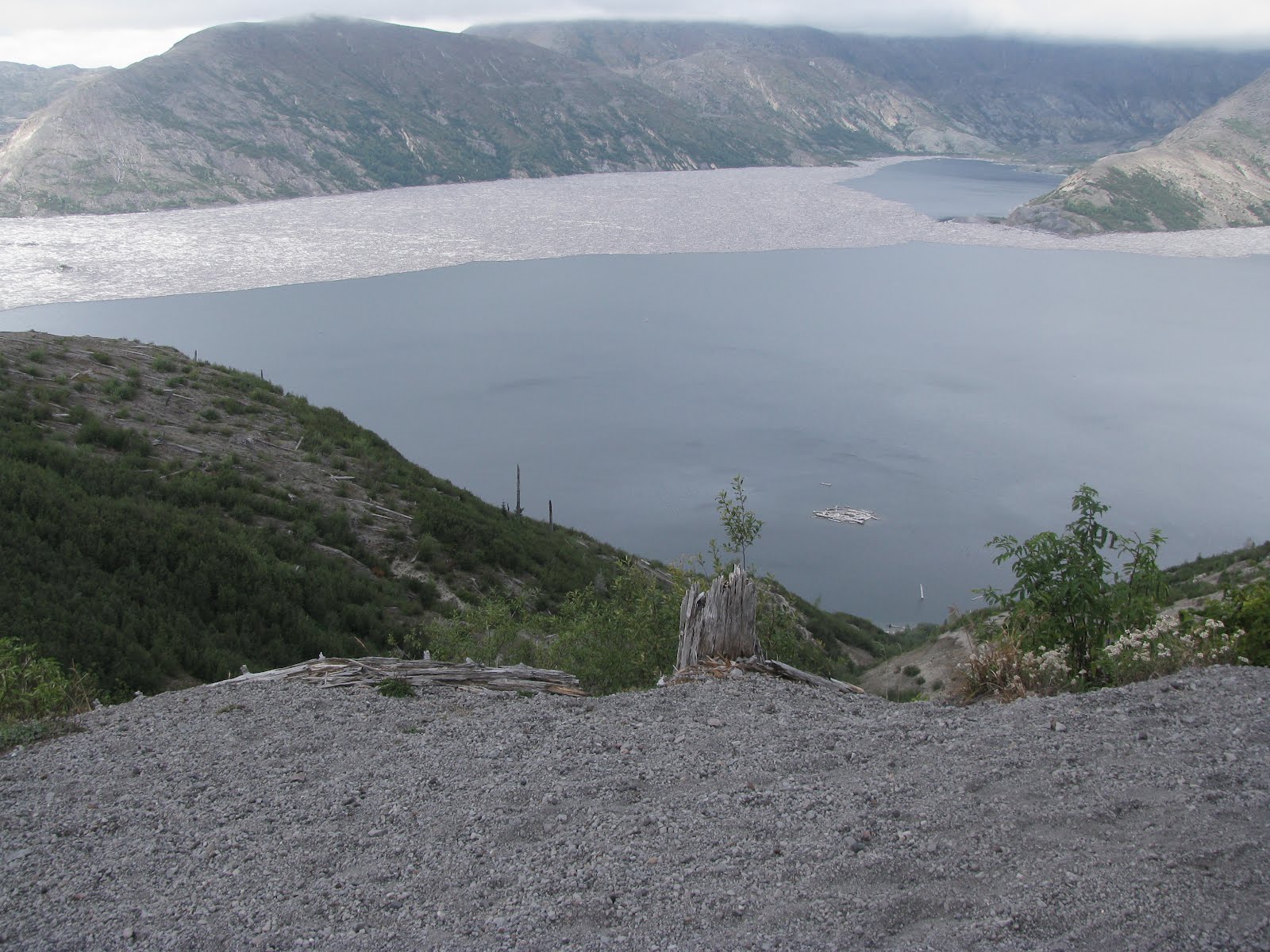
Now we had a great view of Spirit
Lake

. . . so we trekked up the 400+ staircase to the top again,

When we got back down to the bottom, the fog began to lift. Our view of Spirit Lake

Unfortunately it wasn’t. In fact, I think it was worse. This was all we
could see of Spirit
Lake

When we reached Windy Ridge, the fog rolled in, but we decided to climb the
400+ steps to the top to see if the view was better from there.

October 8,2010 – We took a drive up to Windy Ridge on the northwestern side of Mount St. Helens hoping for a better view of the crater
since it is the closest viewpoint accessible to the public. Here you can see the damage to the trees.

A tree trunk embedded in the mud and ash by the landslide.
Remember – this is 30 years later.

Because we were there on such a cloudy day, I took a picture
of a picture that gives you a better idea of what Mount
St. Helens looks like on a sunny day. It’s cheating, I know!! I’m sorry!

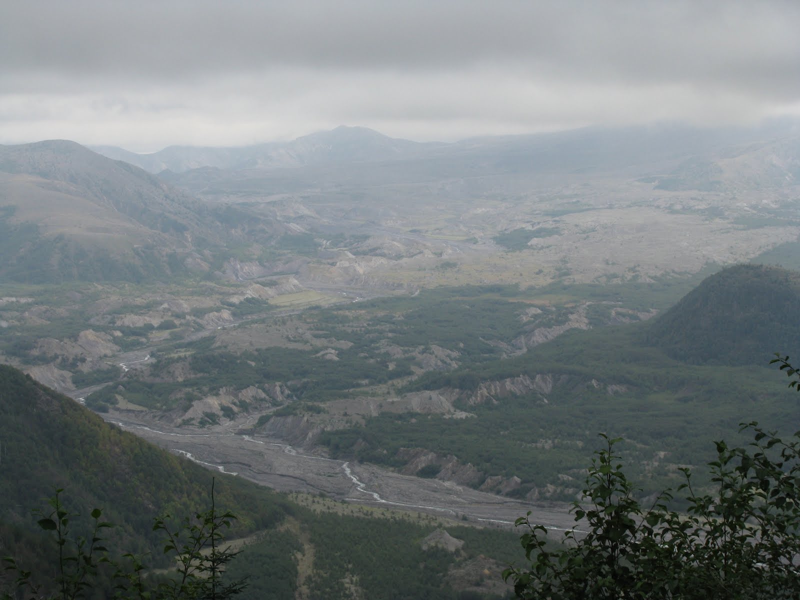
Despite the overcast skies you could still see the lava
dome, crater rim and remains of the lava flow in North Fork Toutle
River Valley
October 7, 2010 – Our next stop was a campground near Ridgefield , Washington Canada Calgary Columbia River eighty kilometres
away. Wind and heat toppled trees. Fifty-seven people died and hundreds of
square miles were reduced to wasteland.
Thirty years later you can still see the devastation caused by the eruption
although the ash has finally been replaced by green vegetation. For four years Weyerhaeuser employees planted
over 18 million trees by hand in an effort to rebuild the forest.

October 6, 2010 – You never know what you’ll see on the Columbia River .

October 5, 2010 – After checking into a campground at Hood River , Oregon , we
went for a drive that circled the base of Mount Hood . At 11,240’, it is the highest peak in Oregon , home to 12 glaciers and considered to be the Oregon Mount Hood each year.

While in Ellensburg, we stayed with our friends, Don and Lynn. They live behind us in Yuma Yakima Lethbridge

October 4, 2010 – A beautiful, lush valley near Ellensburg , Washington on the way to Yakima

October 2, 2010 – After spending our first night on the road
at a WalMart parking lot in Coeur d’Alene, Idaho, we headed west until we
reached the Columbia River near Vantage, Washington.
No comments:
Post a Comment