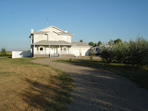
April 5 - We arrived back in Lethbridge. After travelling through 10 provinces, 31 states, 6 time zones and 26,000 miles (40,000 km), we were happy to be "home" to see our family and friends. We'll be taking a break from the blog until we start our trek to Alaska at the beginning of June. We hope you've enjoyed our adventures and will join us as we head north to Alaska! Same drill as before - newest entries at the top; captions below the pictures.
 We salute the U.S.A.! What a great first experience of full-time RVing. The people were so friendly and helpful, customer service was great and the state parks were awesome (our provincial and national parks could really learn from our neighbours to the south). We're looking forward to our escape from the cold next winter! So much more to see and do!
 April 4 - Monida Pass between Idaho and Montana. We were storm-stayed at the fire hall in Lima, Montana a few years ago and were determined not to repeat the experience this trip. Seeing the snow in the distance meant that life as we knew it was over. Our escape from the cold was ending!
 Snow on the mountains north of Salt Lake City - we're starting to feel a real chill in the air!
 April 3 - On our way back to Alberta - neat rock formations in southern Utah.
 After walking a few hundred feet inside, our path was blocked by huge boulders so we were forced to turn back. Our reward when we returned to the gift shop - a date milkshake!!
 The entrance to the crack in the canyon wall.
 We then continued up a large wash which drains into the Amargosa River. As you can see there is no water in it now. You can see the "crack" in the canyon wall which is how the trail got its name.
 The trail then took us across the Amargosa River where we rock-hopped across the river.
 We walked past the Acme Siding, an ore loading site and stop on the Tonopah and Tidewater railroad from 1905 until 1938. You can see the old railroad bed extending into the distance.
 The trail took us past an old saloon building.
 He also got a great view of the path we were taking and me waiting not-so-patiently for him to climb down and get back on the trail.
 China Ranch offered several hiking trails so we chose to hike the Crack Trail. It was about 4 miles round trip but it was worth every step. Ted, being Ted, had to wander off the path and climb to the top of one of the surrounding hills. From the top he had a great view of the date farm - the oasis in the desert.
 Some of the date palms are huge as you can see. I wasn't a big date eater before, but these were delicious.
 Many varieties of dates are grown at China Ranch. This is a Halawy variety from Iraq.
 China Ranch is a family owned and operated small date farm in the Mojave Desert near Southern Death Valley. It truly is an oasis in the middle of the desert. This is the greenhouse where you can purchase various plants and cacti.
 Another view of the road - glad we didn't meet another vehicle.
 March 31 - Tecopa, CA. From Pahrump we drove west into the Death Valley area of California to Shoshone and then to the China Ranch Date Farm near Tecopa. This is another narrow winding road we travelled, but this time we had no choice - it was the only way in.
 This is the main reason I go to Vegas - the seafood enchiladas at Willie and Jose's in Sam's Town Casino. It is simply bursting with shrimp, crab, scallops, melted cheese and more. My mouth is watering just looking at this!
 . . . and Paris all in the space of a few blocks!
 . . . New York . . .
 We just love Vegas. Neither Ted nor I are big gamblers, but we just love people watching and Vegas is the perfect place to do that! The beautiful hotels are a big attraction, too. Where else but Vegas can you visit Egypt . . .
 Now you can see why they call it Red Rock Canyon!
 Pictures can't do the colour of the rock justice. It is just beautiful and such a vibrant red.
 March 29 - After leaving Fort Mohave we stayed in Pahrump, Nevada for a week. We were only 50 miles outside of Las Vegas so of course we had to go visit the city that never sleeps. The road from Pahrump took us past Red Rock Canyon.
 The biggest ripoff of our whole trip. We drove all the way to Grand Canyon West in the hopes of seeing this. The brochure we had indicated we should be able to park (for a fee) and then walk to the rim but when we finally got there after driving 14 of the last 21 miles on a crappy gravel road, we discovered that once you park (for a $20 fee), you must take the shuttle bus (for $29.95 each) to the rim. The bus makes stops at a couple of viewpoints and at a Hualapai Indian village where you can buy lunch. Once you get off the bus at Eagle Point, you can walk onto the Skywalk (above) at an additional cost of $29.95 each. You have to wear special booties on the glass so you do not scratch it and you are not allowed to take your purse, duffle bag or camera onto the Skywalk in case you drop it and mar the glass surface. Instead you put your belongings in a locker (for another small fee) and you can have a tour guide take your picture (for another $20). I'm sure the view would have been awesome, but when we discovered that it would cost us ~$140 (not counting the locker or picture), we decided we would forget the whole thing. We had no problem getting our parking fee back; we think it must happen a lot. Anyway we recommend you skip the west side and go to the south or north rim which is much cheaper. PS - we ripped this picture off their website!!
 The only view we got of the Grand Canyon. Fortunately we'd visited the South Rim twice before so we knew just how amazing it was.
 March 25 - We decided to drive up to Grand Canyon West and saw this mirage of a lake along the Stockton Hill Road north of Kingman. Honest - there is no lake there, only desert sand!
 This roadrunner paid us a visit at our campsite in Fort Mohave. We couldn't believe how fearless it was.
 Spoonleaf yucca in bloom.
 The view from Route 66 was incredible; the desert really is beautiful.
 Along the road we saw real wild burros - not the Oatman burros looking for tourists' carrots.
 From Oatman, we cruised down historic Route 66 to Kingman.
 We saw this poster in one of the gift shops and I had to take a picture of it. I don't know if it's for real or not, but if it is, it has to be one of the most unique pictures ever taken. What an incredible group of Old West heroes and villains - Wyatt Earp, Teddy Roosevelt, Doc Holliday, Butch Cassidy, Sundance Kid, Bat Masterson, to name just a few.
 Another well-known resident of Oatman - a desert tortoise.
 Oatman is known for its "wild" burros roaming the streets looking for tourists to feed them carrots. These burros are descendants of the miners' burros that were left behind when the mines closed.
 Ted thought the inside walls of the mine could use some propping up.
 Right on Oatman's main street are the remnants of an old gold mine.
 The inside decor of the Oatman Hotel consisted of dollar bills - my kind of wallpaper!
 We finally made it to Oatman in one piece and paid a visit to the Oatman Hotel where Clark Gable and Carole Lombard spent their wedding night.
 We also saw cholla cacti alongside the road.
 . . . this wreck of a vehicle that was being used as target practice!!
 March 24 - We plugged "shortest distance" into our GPS to get us from Fort Mohave to Oatman and look at the road she sent us down!! For the most part it was one lane of gravel. We made it through unscathed but we did see some interesting sights including . . .
 . . . a mushroom cloud!! It was a little bit of deja vu after seeing the videos of the atomic bombs being tested in Nevada!! At least there was no radioactive fallout (we think!!!).
 We drove by the U.S. Army Yuma Proving Ground and what did we see but . . .
 March 20 - We left Yuma and headed north to Fort Mohave (near Bullhead City). Along the Dome Valley Road we saw several fields of lettuce, cabbage and other vegetables being harvested.
 Of course we had to pay a visit to Don & Cathy at their winter home in Yuma. Beautiful home, great hospitality!!
 Their daughter, Kristen, and her husband and children, Brooklyn and Taress were also visiting so we enjoyed catching up with them, too. We hadn't seen them since we left Wetaskiwin in 1999 so it was great to see them.
 We discovered that Gord and Sher Peters, neighbours of ours while we lived in Wetaskiwin, were spending the winter in Yuma so we paid them a visit.
 We then drove west over the Imperial Sand Dunes near Glamis and enjoyed watching the dune buggies in action.
  From Felicity we drove north to Ogilby and were fortunate to see several cacti in bloom.
 This is a close up of one of the "Wall of the Ages". This one describes the evolution of man. It certainly was quite an interesting place to visit. It also included a sculpture of "God's Arm" from a Michaelangelo painting, "Dawn of Creation" which served as a sundial and pointed directly toward the pyramid and a metal 25 foot spiral staircase salvaged from the Eiffel Tower. Istel definitely has a wide variety of interests.
 This is a view of the Commemorative Center from the Church. In the distance you can see the pyramid housing the Center of the Universe and another of Istel's unique ideas - the Wall of the Ages. He has created a series of long, 2 sided wedges made of 2 inch thick pink granite. On these walls are inscribed everything Istel thinks is worth telling future generations. Phase 1 is to consist of a hundred walls stretching 1/3 of a mile. On the walls that have already been constructed are the history of French aviation, a U.S. Marine Core Korean War Memorial, the evolution of man and the universe, lists of graduates from various universities - almost anything you can think of. You can purchase space on these walls if you have something you would like to share with present and future generations.
 Istel then went on to build the Hill of Prayer and the Church on the Hill. To build the Hill, Istel had 150,000 tons of earth trucked in. It is in the town's by-laws that the Church must remain the highest point in the town. Istel is founder, owner and mayor of Felicity which at this time only has about a half dozen residents. He became mayor by a vote of 2-0.
 March 19 - Felicity, California. Just a few miles west of the Arizona/California border on I-8 is the most unusual town of Felicity. After making his fortune building successful parachute schools, Jacques-Andrea Istel purchased thousands of acres of land north of the highway and named the town after his wife, Felicity. He wrote a children's book, "Coe, The Good Dragon, at the Center of the World" and then managed to convince Imperial County, CA and the National Geographic Institute of France, that Felicity is the "Official Center of the World". This plaque is found in the middle of a 21 foot tall pink granite pyramid. For $2.00 you can put your toe on the "Center" and make a wish!!!
 This is more my idea of boondocking - a nice lake to look at and, most importantly, washrooms!!! I guess I'm a bit of a princess!!
 We arrived in Yuma on March 14 and on the 17th we went for a drive to the Imperial Dam. On our drive we saw many trailers "boondocking" out in the middle of the desert.
 This is the elevator after the hatch doors opened and it reached the surface. In the museum we watched various videos including a kids' video entitled "Duck for Cover" which was supposed to prepare children for a nuclear attack. The advice they gave was silly and ridiculous in retrospect. We also saw videos of the atomic bombs that were detonated in Nevada while observers simply stood and watched while clouds of radioactive fallout engulfed them.
 The doors you see opening allow an elevator to rise from the underground silo to the surface. From the top, it was difficult to believe that such a huge complex existed below ground.
 This is the underground launch control centre. Two people manned the control centre at all times for safety reasons. Ed and a tour member simulated a missile launch for us. After seeing the complex and touring the museum, we realized how lucky we were that cooler heads prevailed and the Cold War never escalated into a nuclear conflict.
 This is the long hallway from the Mission Control Centre to the launch duct. Note the huge shock absorbers and springs that act as cushions in case of an earthquake. Extreme measures were taken to prevent an accidental launch.
 Our guide, Ed, was incredibly knowledgeable about the missile site and the Cold War. Most of the complex was over 100 feet below ground. The doors in this picture are 3-ton blast doors and the silo walls were 8 feet thick.
 March 11 - Titan Missile Museum, Sahuarita, AZ - While in New Mexico we met a couple from Vulcan (another "it's a small world" moment) who recommended we visit the Titan Missile Museum. At one point during the Cold War, 54 Titan II missile complexes were "on alert" across the U.S. This is the only one left and is home to the last preserved Titan II Intercontinental Ballistic Missile. This site, complex 571-7, was completed and turned over to the U.S. Air Force in 1963 and was deactivated in 1987. The Titan II was equipped with a nine-megaton thermonuclear warhead and was capable of reaching its target half way across the world in less than 30 minutes. Our guide told us that one warhead could destroy 1000 sq. miles so 3 would completely destroy an area the size of the U.S. Having 54 of them aimed at the Soviet Union was "a bit of overkill" in his opinion (and ours!!!). This is the 103 foot tall Titan II missile in its launch duct.